Are you planning a trip to Valley of Fire State Park? We’ve got you covered with everything you’ll need to know to enjoy your time exploring the unique, natural beauty of the park.
The vibrant, red Aztec sandstone appears like a blazing fire in a landscape otherwise dominated by grays and tans. When sunlight hits the rocks it holds your gaze and you can’t help but marvel at how appropriate the name “Valley of Fire” is. It is one of the best stops on any Southwest Road Trip!
The park is quite large at 40,000 acres and boasts the title of Nevada’s oldest state park. The park holds an immense amount of history, both natural and human, from the sandstone that has shifted and been molded over millions of years to the petroglyphs that tell the stories of the ancient people who once inhabited the area.
Beyond understanding the history of the park, there are excellent hiking opportunities, scenic roads that allow you to enjoy the beauty while resting your feet, and breathtaking viewpoints for your eyes to soak in and your camera to capture. A $10 entrance fee is all that stands in the way of you and this magnificent landscape.
The park is a perfect day trip from Las Vegas or can be incorporated as part of a larger Southwest road trip as you head to or from Utah. However you choose to experience the Valley of Fire, you won’t regret making the trip.
Getting To Valley Of Fire
As mentioned above, Valley of Fire State Park is the perfect day trip from Las Vegas. Just one hour of driving will take you from the Vegas Strip to the park’s west entrance.
When traveling from Last Vegas to Valley of Fire, not only is the drive time reasonable, but the directions are easy to follow as well. You’ll spend much of the time on the I-15 north before driving on the Valley of Fire highway to reach the entrance station.
If however you are seeking the warmth of the desert as an escape from Utah’s wintery cold, you can reach Valley of Fire’s east entrance in just 1.5 hours from St. George, Utah (near the Nevada border). While you can easily spend multiple days exploring the park, you can hit many of the major attractions in half a day, so with the minimal time and distance required to reach Las Vegas and St. George you could easily return to one or the other at night.

Getting Around Valley Of Fire
There are two prominent roads through the Valley of Fire State Park. The Valley of Fire Highway runs east to west through the park while the White Domes Road (or Mouse’s Tank Road) runs south to north perpendicular to the highway.
White Domes Road is 6 miles long and take you by the Visitor’s Center as well as many of the parks biggest attractions. The road itself, from a certain angle and vantage point, is one of the most photographed spots in the park.
Another 3 mile long scenic loop passes the two park campgrounds. Throughout your entire time in the park be sure to stick to designated roads and parking areas. There is no off-roading allowed in the park and you will not be allowed to park on the side of the road once you are past Mouse’s Tank.
Driving through the park and admiring its natural beauty is as much a part of the experience as stopping at the major attractions. Valley of Fire is full of short hikes and unusual rock formations as well, many of which are easily accessible from the main roads.
The park is open from sunrise to sunset unless you’re staying the night at one of the campgrounds.
Best Things To Do In Valley Of Fire
Photograph Mouse’s Tank Road
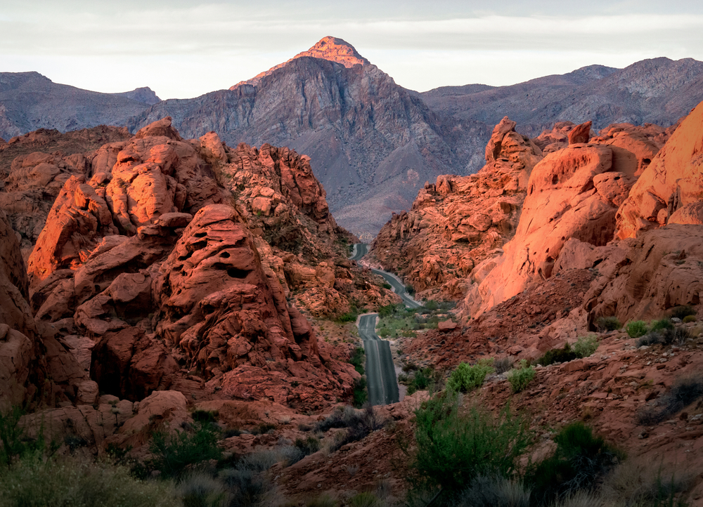
One of the most exciting things to do in Valley of Fire that doesn’t involve hiking, is photographing Mouse’s Tank Road (or White Domes Road). A particular spot along the road is one of the most photographed locations in the park and for good reason. The view of the road when driving north to south is breathtaking.
Like the parting of the red sea, the road splits the fiery red sandstone down the middle. Like waves, the rock rises up around you, and a towering mountain in the distance completes the picture.
To reach this iconic spot you’ll want to drive from the Visitor’s Center down Mouse’s Tank Road until it dead ends at the White Domes Loop (5.7 miles). Feel free to stop at the park’s many other attractions along the way if you’re not in a rush. When you reach the end, turn around and drive back in the direction of the Visitor’s Center. Near the Rainbow Vista trailhead is where you’ll find yourself gaping at this incredible view.
Because you’re photographing one of the park’s major roads that sees constant traffic throughout the day, you’ll want to attempt your photographs around sunrise or sunset when there are less cars around. No drones are allowed in the park but there are plenty of vantage points in the area that allow you to capture ideal photographs without a drone.
As we mentioned, this spot on Mouse’s Tank Road is iconic, so be prepared to share this magical spot with others. Be respectful and let everyone have their turn capturing this slice of beauty.

Hike Through Petroglyph Canyon To Mouse’s Tank
Now you know of the beauty surrounding Mouse’s Tank Road, but this .7 mile hike takes you to the tank itself by way of the Petroglyph Canyon. This hike is immersed in history from the stories carved into the rock to the story that gave Mouse’s Tank its name.
As you head up White Domes Road (Mouse’s Tank Road) from the Visitor’s Center, you’ll come across the trailhead roughly a mile up the road. The trail takes you southeast along sandy terrain.
As you hike along, keeping your eye out for desert varnish (a dark layer coating the sandstone) will allow you to more easily spot the petroglyphs along the trail. You won’t have to wait long as you’ll find your first set of petroglyphs 1/8 of a mile into the hike.
More petroglyphs can be found as you continue down the trail. You’ll spot everything from animals that resemble Bighorn sheep to human figures holding hands. These prehistoric petroglyphs are a fascinating reminder of the human history of the area.
To reach the “tank” itself you’ll veer left after .35 miles where you’ll shortly find a naturally formed collection pool filled with rainwater. Though this site isn’t nearly as visually fascinating as many of the other points of interest in the park, its story is of great historical significance.
A Southern Paiute by the name of “Little Mouse” hid out in Valley of Fire after being accused of killing two prospectors, among other crimes. He found refuge in this canyon, relying on the “tank” and its precious water to survive until he himself was eventually surrounded and killed. And so the name Mouse’s Tank was born.
When you’re finish your hike you’ll return back the way you came following the same out and back trail to the trailhead.
Explore Pink Canyon And Its Pastel Colored Walls
The Pink Canyon (or Pastel Canyon) is one of the park’s hidden gems, therefore you won’t find it on any of the park maps. As a result it’s not always the easiest of the park’s attractions to find.
The canyon itself is located at 36.480408, -114.525560 not far from Mouse’s Tank Road. You are no longer allowed to pull off and park on the side of the road however, which means you’ll need to hike to the canyon from the famous Fire Wave instead.
We suggest parking at Parking Lot #3 which is where the Fire Wave trail begins. As one of the most popular hikes in the park, the Fire Wave trail is clearly marked. From the Fire Wave you’ll continue hiking down the hill until you reach the wash below. Though the path from the Fire Wave to Pink Canyon is not marked, you’ll find it’s easier to follow than you might expect.
When you reach the wash, you’ll follow it west in the direction of Mouse’s Tank Road until you reach Pink Canyon. As one of the lesser known natural wonders in Valley of Fire State Park, you’ll not only be able to enjoy the beauty of the canyon, but you’ll enjoy a level of peace and solitude not often found in the rest of the park.
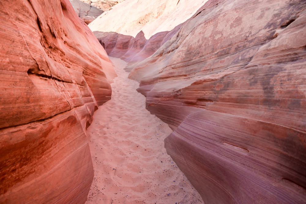
The name is a dead giveaway as to what to expect when you reach the canyon. You’ll be met with striking canyon walls of a distinct pastel pink color. Oranges and yellows also appear in the canyon walls creating a pleasant sunrise color palette that you can’t help but admire.
When you’re finished wandering the canyon you’ll head back to the Fire Wave and follow the Fire Wave trail back to parking lot #3. Two of the park’s most spectacular natural formations in one hike…what more can you ask for?
Hike To The Famous Fire Wave
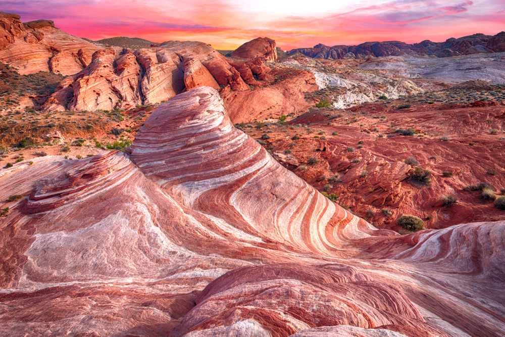
When you’re standing in front of the dramatic swirls of color that make up the Fire Wave, it’s easy to see why this is one of the best hikes in the Valley of Fire. You’ll be delighted to know that the hike to this iconic natural wonder is only 1.5 miles out and back and is not very difficult to reach.
To begin this hike you’ll head to Parking Lot #3 on White Domes Road (Mouse’s Tank Road) where you’ll park the car before heading across the street to the start of the trailhead. The start of the trail is full of loose sand that can be more challenging to navigate however it won’t be long before it transitions to tightly packed sand.
As you continue on the trail you’ll make your way alongside a particularly notable rock formation called Gibraltar Rock that juts out of the rock structure beside it. Every section of this hike is fascinating and beautiful in its own right so be sure to keep your head up and take in your surroundings. The vibrant desert landscape will not disappoint.
The hike will later take you across slickrock leading you closer and closer to your final destination. Much of the hike to Fire Wave is downhill until you reach the base of the Fire Wave rock formation itself. A brief uphill climb will take you up the sandstone slope until you can spot the Fire Wave below.
Though the structure is not particularly large, its colors and dramatic wave-like shape and patterns make it fascinating. Strips of orange, red, and beige drape themselves like ribbon across and around the unusual landscape.
The Fire Wave is particularly remarkable at sunset, but as one of the most popular hikes in the park you should prepare to stake out your spot early in the evening, as there will be many other photographers hoping to get their own perfect shot. If you’d rather tackle this hike earlier in the day, plan to make it your first stop of the day before the parking lot fills up and the heat becomes too severe.
Hike The Diverse Landscape Of The White Domes Loop
The White Domes Loop is one of the best hikes in Valley of Fire due to its remarkable, diverse landscape. A 1.1 mile loop takes you through a brilliant array of rock formations, film set ruins, and a small but beautiful slot canyon.
The White Domes trailhead (36.4859, -114.5329) is located at the end of the White Domes road (also known as Mouse’s Tank road). You’ll park at the White Domes Day Use Area just .9 miles past Parking Lot #3 where there are toilets and picnic tables for your convenience.
Head south from the parking lot to begin your hike through large rock formations and down a set of sandy steps into a wash. Just .3 miles into the hike you’ll come across ruins from the set of the 1966 movie “The Professionals.” Though not much remains, it’s an interesting stop to see what little of the structure is left.
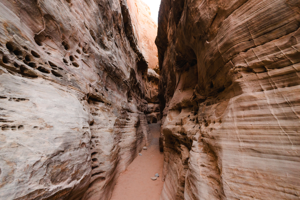
From the film sent you’ll cross the Kaolin Wash before arriving at the small slot canyon. The slot canyon only reaches a length of about 200 feet, but it’s a beautiful section of the trail, narrowing until you’re traveling through a space that’s only 3 feet wide.
The remainder of the hike gives you spectacular views of an otherworldly landscape of pinks, oranges, and the signature brilliant red of the sandstone ridges in the background. The complete hike is not particularly long, but if you’re extra short on time or know there’s a particular section of the hike you’d like to see, you can easily just hike a section of the trail and return back the way you came.
Due to the popularity of this hike, the parking lot fills up quite quickly so plan to arrive early both to snag a parking spot and escape the relentless midday sun. You’ll want to avoid this hike during the summer monsoon season when the wash has the potential to fill up with water from flash floods, making parts of the trail potentially dangerous and impassable.
Visit The Valley Of Fire Slot Canyon
The slot canyon on the White Domes loop is arguably the best part of the White Domes hike. You’ll follow the loop clockwise and shortly after passing the ruins of the old film set, you’ll come across the slot canyon (36.4815, -114.5344).
Though the slot canyon is less than 200 feet long, it packs a lot of punch. From the beautifully colored rock walls to the unique shapes sculpted by time and weather, you can’t help but enjoy your brief journey through the pinks, oranges, browns, and whites of the canyon.
You’ll find that at some points the path narrows to a width of roughly three feet. Embrace your time here as it’s one of the few respites you’ll have from the sun, and this colorful adventure through the slot canyon will be over before you know it. From here you can choose to hike back the way you came or continue hiking the rest of the White Domes loop.
Once again you should take note that this area is particularly dangerous during flash floods and should be avoided during the monsoon season.
See The Uniquely Shaped Elephant Rock Formation
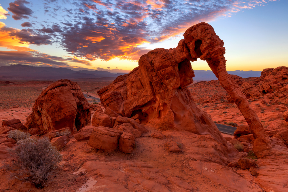
Elephant Rock is the perfect quick stop to kick off your Valley of Fire adventures. If you’re entering the park from the east entrance, you’ll find the unique rock formation just a few miles inside the park along the main Valley of Fire Highway.
Though the rock is visible from the road you’ll want to hike to its base to get a better look at it. You’ll park in the designated parking lot and follow the trail northwest. Early on in the hike you’ll reach a junction at which point you can decide whether to veer left for the .3 mile out and back version of the hike or continue on the loop for a total of 1.2 miles.
You’ll soon come across main attraction itself, a towering, majestic elephant seemingly trudging through the desert landscape. The sandstone arch that creates the trunk is what makes the rock formation distinctly elephant-like in its appearance.
This remarkable sandstone formation is delicate and should not be damaged in any way. You are not allowed to climb the rock so be prepared to take any pictures you’d like from the base of the structure.
If you plan to take on other hikes in the park you might consider limiting this stop to the .3 mile out and back version. Either way it’s a nice way to stretch your legs and whet your appetite for what is still to come.
Drive Through The Park And Marvel At The Red Rocks
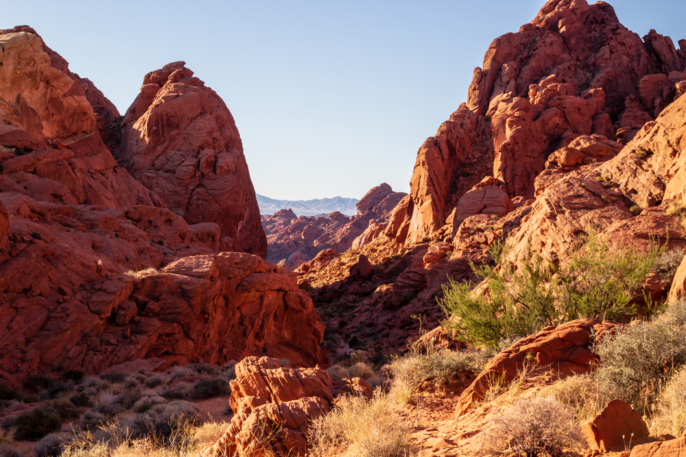
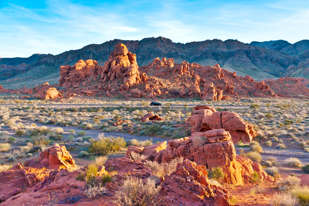
Valley of Fire is unique in that so much of its natural beauty can be viewed from the comfort of your car. Though of course there’s much to be gained from embarking on any of the short hikes or taking in the rock formations from up close, you can certainly appreciate the natural beauty of the park by driving down its two major roads.
Mouse’s Tank Road (White Domes Road) is known for its iconic view driving north to south with the red rock rising up around the road and the mountains in the distance. Though this is the most photographed spot along the road, the natural beauty and vibrant colors are not limited to this one location.
The Valley of Fire Road is no slouch either offering you views of iconic sandstone formations such as Elephant Rock near the park’s east entrance or the Beehives, an excellent example of cross-bedding, on the west side.
As you pass the vibrant sandstone, you’ll have no problem understanding exactly how the park got its name. And these scenic drives throughout the park allow you a prime opportunity to admire its fiery brilliance.
View Petroglyphs Up Close At Atlatl Rock
Atlatl Rock is a short but historically significant stop. The rock is located near the park’s west entrance on a 3 mile scenic loop that also takes to the park’s main campgrounds.
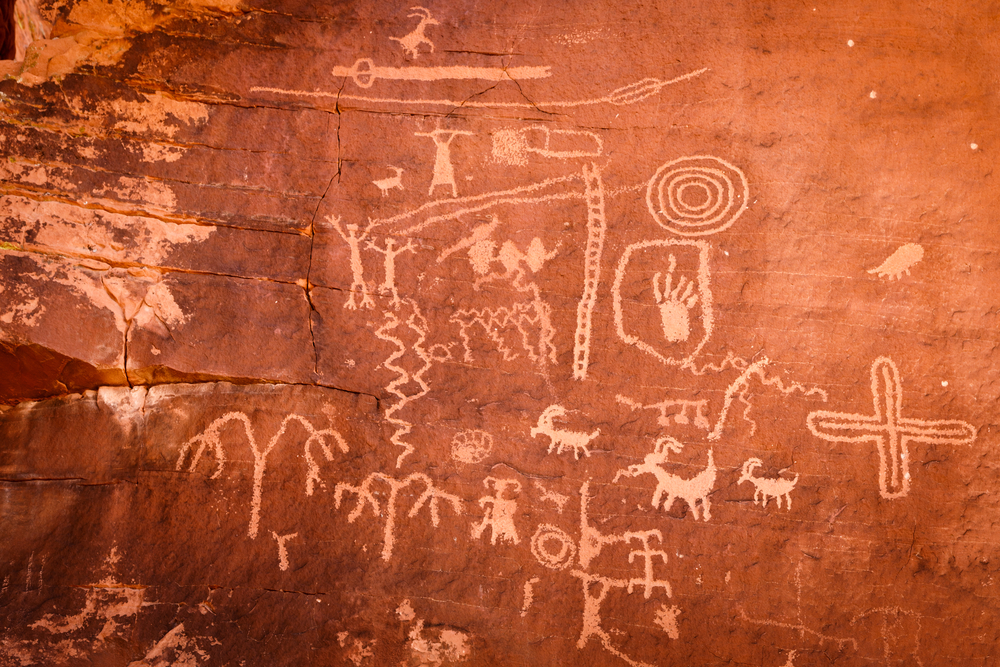
This rock formation is particularly notable because of the over 4,000 year old petroglyphs carved into its side. These petroglyphs can be reached by taking a short walk to the base of a staircase installed on the side of the rock, and then climbing the staircase to the viewing platform. In total it only takes about 250 feet of walking and climbing.
The trailhead coordinates are 36.42306, -114.550535. You can see the staircase and rock from the road, so they’ll be easy to find.
Just like at Petroglyph Canyon, the images are carved into desert varnish, a darker layer on top of the red sandstone. This makes the petroglyphs stand out as they reveal the red coloring underneath.
When you reach the viewing platform, you’ll be met with a wide variety of carvings that depict everything from animals to symbols whose significance is more difficult to decipher. The rock got its name however from a carving you’ll find towards the top of the panel. There you’ll see an atlatl which is type of throwing stick that the ancient tribes used as a way to throw their darts and spears with more speed and force than they’d otherwise be able to.
As you turn around to make your decent, take a look out from the platform and admire the vast desert landscape around you from this unique vantage point.
This is an obvious stop for those staying at the neighboring Atlatl Rock Campground, however it’s an easy and enjoyable stop for anyone visiting the park and can be enjoyed at any time of the day.
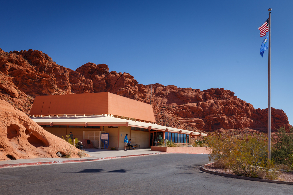
Learn About The Park At The Visitor Center
The Visitor Center is open daily from 8:30am-4:30pm and we highly suggest making it one of your first stops after entering the park. Right in the middle of the park on White Dome’s Road (Mouse’s Tank Road) is where you’ll find the Visitor’s Center. You’ll come across it shortly after turning off of the Valley of Fire Road.
There’s no better way to get a feel for the layout of the park, learn about it’s history, and take care of essentials like bathroom breaks and filling up your water bottles (which you’ll be particularly grateful for in the hotter months). The Visitor Center’s exhibits and interpretive displays will inform you on everything from the geology of the park to the prehistoric inhabitants of the area.
Valley of Fire is a place of fascinating history both human and natural, and it helps to know what you’ll be seeing and experiencing before you lace up your boots and walk among it all.
This is also the perfect time to take note of the rules and regulations of the park so that you can protect the sometimes fragile desert landscape. And if you have any questions about the park, there are park rangers around who are happy to help.
Soak In The Views Along The Rainbow Vista Trail
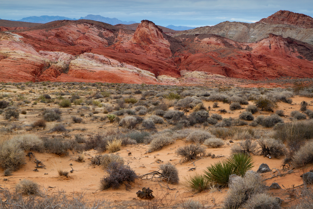
The Rainbow Vista Trail is located along White Domes Road (Mouse’s Tank Road) just a short distance beyond Mouse Tank. You’ll park in a small parking lot by the trailhead (36.45083, -114.51535).
This is yet another one of the best hikes in Valley of Fire that is relatively short and sweet with a big payoff. The Rainbow Vista hike can be done as a short loop or can be extended to include the Fire Canyon Overlook. Even the complete hike to Fire Canyon Overlook is only about 1.1 miles round trip.
If you choose to complete the Rainbow Vista loop you’ll head left at a junction partway through the hike that will take you to the crest of a hill where you can enjoy the stunning, colorful landscape around you. If however you’d prefer to follow the trail on to the Fire Canyon Overlook, you’ll head right at the junction instead.
Though the beginning of the Rainbow Vista Trail is clearly marked, it doesn’t take long for the trail markings to peter out leaving you to follow the trail as best you can. The good news is that the rocks naturally create a pathway, leading you into the canyon.
You’ll continue through the canyon as it narrows and deposits you at the end of the canyon where there’s a drop off and spectacular views. The entire hike takes you through many photograph worthy, colorful desert landscapes, however it can be appreciated more completely from the overlook.
When you’ve taken in your fill of the scenery from the overlook you’ll head back the direction you came in order to reach the parking lot. This hike may not have an iconic formation like the Fire Wave, but it’s certainly worthy of your time and is a true celebration of the natural beauty that the park holds.
Camping In Valley Of Fire
Camping in Valley of Fire is an excellent way to spend the night among the beauty of nature and have easy and quick access to the park’s natural wonders. Both of the park’s campgrounds are located near the park’s west entrance on a 3 mile scenic loop road that connects to the main Valley of Fire road on both ends.
Arch Rock Campground and Atlatl Rock Campground are both first come first served and offer a total of 73 campsites between the two. On top of your park entrance fee, you’ll pay $20 a night to camp as well as an additional $10 if you need utility hook ups.
You’ll have access to potable water and pit toilets at both locations. For tent camping you might consider trying to snag one of the 29 spots at Arch Rock Campground as it lacks the showers and electric hook ups that RV campers seek.
Atlatl has both of these additional amenities as well as barbecue grills and picnic tables, and is the larger of the two campgrounds with 44 sites. Feel free to try to tent camp here as well just keep in mind you’re more likely to be sharing the campground with RVs and trailers.
Regardless of which campground you choose you’ll have easy access to attractions such as the Beehives, Atlatl Rock, and the petrified logs that are all located on or near the same scenic loop drive that passes the campgrounds.
The park also offers a group camping area with three different sites that can accommodate up to 45 people. You’ll call and make a reservation ahead of time to reserve these sites.
You should note that although the park is only open from sunrise to sunset, the campgrounds and the areas directly around them remain open at all times.
We’re thrilled that you’ve chosen a trip to Valley of Fire as your next adventure. It’s truly a slice of desert paradise with a color palette that’s hard to fully appreciate until you’re staring it in the face.
You’ll want to avoid planning your trip during the summer months when the sun and heat is particularly relentless, but the park is an ideal trip at any other time of the year. Regardless of when you visit, be sure to bring plenty of water (this is a desert after all), and don’t forget your camera to take endless photographs of the stunning natural landscape.
From the human history to the fiery red sandstone there’s so much to marvel at and plenty of things to do in the Valley of Fire State Park. If you have any questions or comments as you plan your trip to this vibrantly colored park, feel free to let us know in the comments section below.

 26 Things To Do In Italy: The Ultimate Bucket List